


 Elektromos városi közlekedés
Maps
San Jose
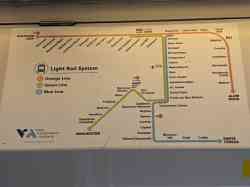 |
San Jose, VTA Light Rail 900 Series — 962 — Viszonylat G, Green Line Winchester Line 11 október 2021 . |
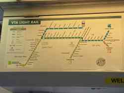 |
San Jose, VTA Light Rail 900 Series — 970 — Viszonylat G, Green Line Winchester Line 8 október 2021 . |
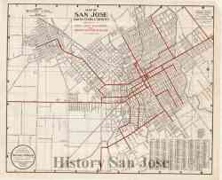 |
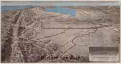
History San Jose Collection https://historysanjose.pastperfectonline...7778943 1924 . |
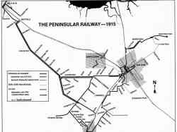 |
Rod Sinks 1915 . |
 |
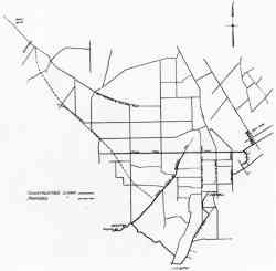
History San Jose Collection 1910-s évek |
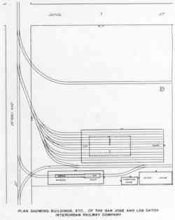 |
Peninsular Railway Yard július 1905 . |
 |
Internet Archive: The Journal of Electricity Power and Gas 1905-07: Vol 15 Iss 7 (clipped by Derek Whaley at https://www.santacruztrains.com/2021/07/...os.html) július 1905 . |
Sötét nézet
A honlapon szereplő képek felhasználása a szerzők hozzájárulása nélkül tilos!.