


 Pilsētas elektrotransports
Maps • Netzpläne
Chemnitz
 |
See also: https://transphoto.org/photo/1912984/ Decembris 2023 g. |
 |
See also: https://transphoto.org/photo/1912985/ Decembris 2023 g. |
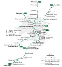 |
Tram-railway system "Chemnitzer Modell" • Straßenbahn-Eisenbahnkonzept "Chemnitzer Modell" Source: ZVMS, VVHC 2022 g. |
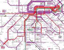 |
Liniennetz der Straßenbahn (rot) und CityBahn (grün), gültig ab 13.12.2020 • Схема маршрутов трамвая (красный) и СитиБана (зелёный), действует с 13.12.2020 г. • Map of the tram (red) and CityBahn (green) routes, valid from 13.12.2020 2021 g. |
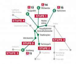 |
Tram-railway system "Chemnitzer Modell" • Straßenbahn-Eisenbahnkonzept "Chemnitzer Modell" Darstellung der Ausbaustufen des Chemnitzer Modells • Схема стадий расширения трамвайно-железнодорожной системы «Хемницер Модель» • Map of the expansion stages of the tram-railway system "Chemnitzer Modell" 2020 g. |
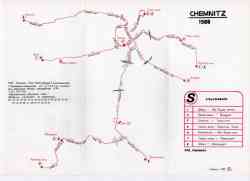 |
1988 g. |
 |
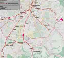
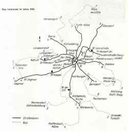
Das Schema der Entwicklung der Straßenbahnlinien 1880-1984. 1984 g. |
 |
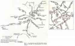
Schema der Straßenbahnlinien 1953. 1953 g. |
 |
Schema der Straßenbahnlinien 1945. 1945 g. |
Dark Theme
Vietnē publicēto fotogrāfiju un citu materiālu izmantošana ir atļauta tikai ar viņu autoru atļauju.