


 Sähköinen kaupunkiliikenne
Maps
Gent
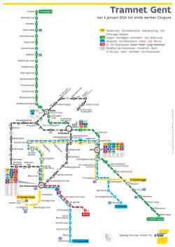 |
The new tram map from 06/01/2024. There are now 4 routes (T1 to T4) instead of 3 (1-2-4). Due to works, the new route T4 has been shortened and a shuttle bus (P4 on the map) is running temporarily. 6 tammikuuta 2024 v. |
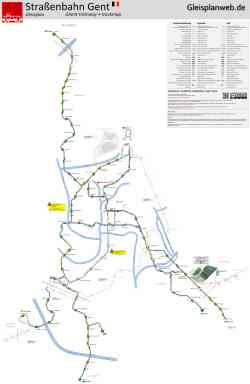 |
Source: www.gleisplanweb.eu tammikuu 2024 v. |
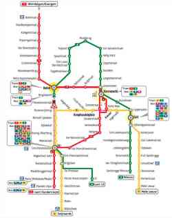 |
Map valid between 01/10/2023 and 05/01/2024. 1 lokakuuta 2023 v. |
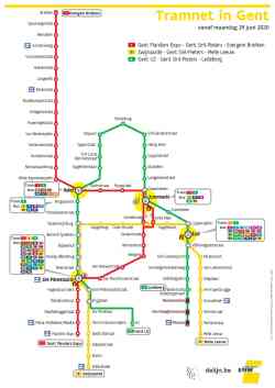 |
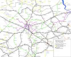
Source: https://www.delijn.be/nl/content/netplan...nderen/ 29 kesäkuuta 2020 v. |
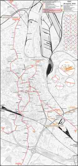 |
28 maaliskuuta 2018 v. |
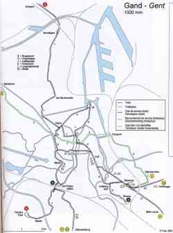 |
Схема из атласа трамваев, троллейбусов и метро Бельгии: FLASH België - 4-de editie, maart 2006 maaliskuu 2006 v. |
 |
Map of the N.M.V.B./S.N.C.V. in and around Ghent in 1940 (non-electrified lines; green and yellow when out of the province) and 1954 (electrified lines; pink and orange when out of the province. Black = N.M.B.S./S.N.C.B. (railway). 1954 v. |
Tumma tila
Minkä tahansa sivuston kuvan käyttö ilman kuvaajan lupaa on kielletty.